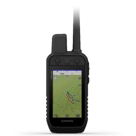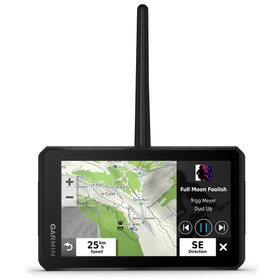
* Rugged designed
* 5 inch high resolution display
* High-sensitivity GPS and GLONASS receiver with quad helix antenna
* 16 GB of internal memory and a microSD card slot
* Includes BirdsEye Satellite Imagery download
* Topoactive AU/NZ map
* 3-axis compass with barometric altimeter
* Smartphone paired with Garmin Earthmate App
* Waterproof (IPX 7) and rechargeable
* 12 month warranty
Important ! Please perform software and firmware update for Garmin products before use.
Garmin Montana 700 Rugged Outdoor Handheld GPS Navigator
- SKU:
- 94-GAH-040
- UPC:
- 753759215040
- Condition:
- New
Enhance your experience in the outdoor with the Garmin Montana 700 Handheld GPS Navigator, featuring routable topographic maps, BirdsEye satellite imagery, multi-GNSS networks, and ABC sensors—altimeter, barometer, and three-axis electronic compass. This unit utilizes GPS, GLONASS, and GALILEO satellites to track your position, even in challenging environments. It feature a 5” dual-orientation touchscreen colour display that’s 50% larger than earlier models. The built-in rechargeable lithium-ion battery lasts up to18 hours in normal use, and with the exception of GPS Expedition Mode, it can last up to 300 hours. It connects to your phone via Bluetooth by the Garmin Connect app and you'll have access to active weather forecasts and the LiveTrack feature, which shares your tracks, routes, and waypoints with other Garmin GPS users.
RUGGED BY DESIGN
This durable, water-resistant handheld is tested to U.S. military standards and features a glove-friendly 5” touchscreen that’s 50% larger than previous Montana models
TOPOACTIVE AUSTRALIA AND NEW ZEALAND MAPS
To navigate your adventures, use preloaded TopoActive Australia and New Zealand maps. View elevations, coastlines, rivers, landmarks and more.
SATELLITE VIEWS
Use direct-to-device downloads of BirdsEye Satellite Imagery (no annual subscription required) to see photo-realistic views and create waypoints based on landmarks.
ABC SENSORS
Navigate your next trail with ABC sensors, including an altimeter for elevation data, barometer to monitor weather and 3-axis electronic compass.
General |
|
| PHYSICAL DIMENSIONS | 8.76 x 18.30 x 3.27 cm |
|---|---|
| TOUCHSCREEN | |
| DISPLAY SIZE | 6.48 x 10.80 cm; 5" diag (12.70 cm) |
| DISPLAY RESOLUTION | 480 x 800 pixels |
| DISPLAY TYPE | WVGA transflective, dual orientation |
| WEIGHT | 397 g with included lithium-ion battery pack |
| BATTERY TYPE | rechargeable lithium-ion (included) or 3 AA batteries (not included); lithium recommended |
| BATTERY LIFE | GPS Mode: up to 18 hours Expedition Mode: up to 330 hours |
| WATER RATING | IPX7 |
| MIL-STD-810 | yes (thermal, shock, water, vibe) |
| HIGH-SENSITIVITY RECEIVER | |
| INTERFACE | High speed micro USB and NMEA 0183 compatible |
| MEMORY/HISTORY | 16 GB (user space varies based on included mapping) |


